| Location | Fowey, Cornwall, UK. |
| Date | April, 2021 |
| Activity/ Tech used etc… (bullet points) | 3D Laser scanning of 29 meter grab hopper dredger Lantic Bay.
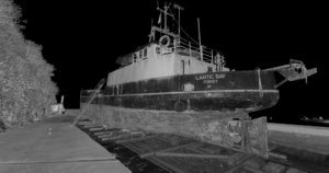
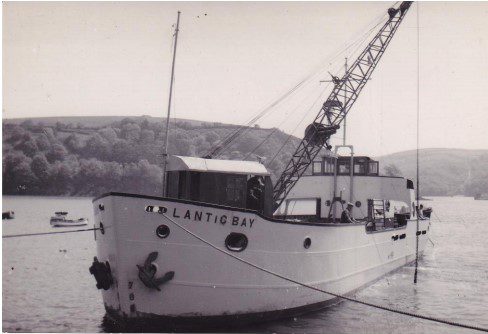
The vessel: Lantic Bay is a 95ft dredger based in Polruan on the Fowey Estuary. She is owned by C. Toms and Son Ltd and is known as one of the most successful builds of Brazen Island shipyard. Lantic Bay has undergone multiple previous modifications to enable her to move vast quantities of dredged material from Fowey Harbour. The job: Working with the shipyard, Fowey Harbour Commissioners and a naval architect to oversee Lantic Bay’s refit and the installation of a new digger mounted on her forward deck. Our role was to scan the hull to provide the basis for updating her stability book and to check if the deck structure was strong enough to support the new digger.
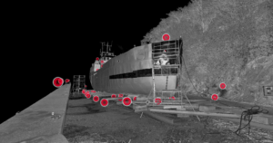
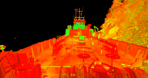
The challenges: Whilst a relatively straightforward scan, we aimed to complete work within one day whilst navigating the underneath of the vessel, narrow hatchways and ladders. What we did: After completing the necessary health and safety checks, we scanned the vessel upon the same slipway she was originally built. 130 scans of the hull were completed within 7 hours using a laser scanner, to produce a digital twin. All scans were carried out without causing any disruption to the yard team or the yard’s workflow. The yard manager was able to see the data on an ipad before we left the site.
The outcome: Data was available to the client (M2ED Ltd.) within three days of the scanning survey being completed. The data provided a model of the hull and deck of Lantic Bay in a format which could be used to assess the vessel’s stability characteristics and update her stability book. This made it possible to determine how much load she can safely carry, influencing the design of the new digger. Without 3D laser scanning, the client would have been required to spend several days taking manual measurements to produce an estimate of the hull shape, or to rely on original (and potentially outdated) stability data. The overall result was a significant time and cost saving, plus improved accuracy and a better stability book, making for a safer vessel. Testimonial: “What they can achieve in a short time period is not only far more accurate than existing techniques, the cost savings are also very significant” – Miles Pinchin, Naval Architect, M2ED Ltd. |
| Outcome/ end benefits to client | The vessels original drawings could not be found.
Provided accurate displacement. Provided accurate CAD surface models of the hull and appendages. Data processing delivered within 1 week after the survey was conducted. All data stored securely ready to assist in future refits and modifications. |